

Taunton, Somerset · TA4
Waterrow, Nr Wiveliscombe
Guide price
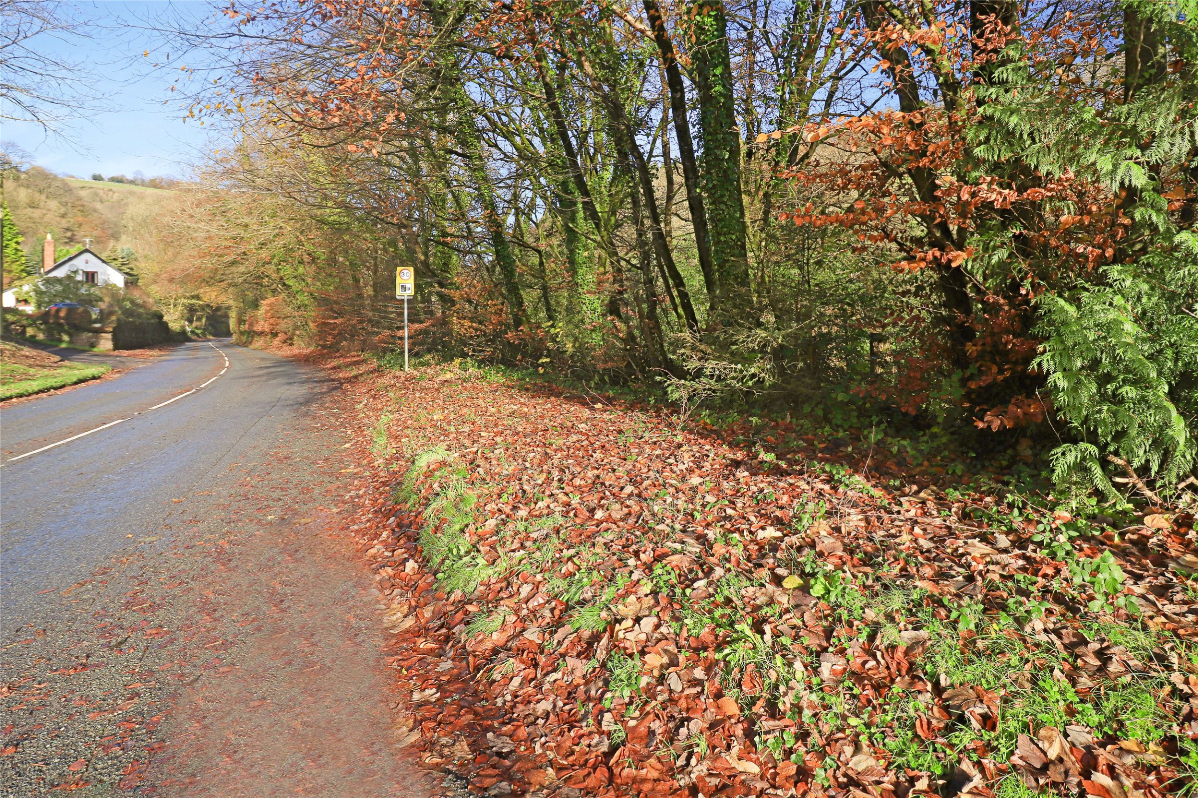
A small section of woodland between the B3327 and The River Tone in the village of Waterrow, two miles west of Wiveliscombe.
The home, in the agent’s words
- Signature Homes
Read the full agent description
We are delighted to offer for sale this small piece of woodland in the village of Waterrow, 2 miles west of Wiveliscombe.
It is set between the B3327 and The River Tone and is sloping woodland.
The woodland is located on the edge of Waterrow, which is a small village nestling in the foot of the Brendon Hills, close to Exmoor having lovely views of the surrounding hills and woodland. There is a popular local Inn and village hall.
The Wiveliscombe area is the best kept secret in Somerset with rolling green hills and peaceful unspoilt countryside, whilst maintaining excellent access to communities in Taunton, 11 miles with main line railway station and M5 access junction 25 and Wellington junction 26 is 7 miles from Wiveliscombe.
Wiveliscombe town offers an unusually wide range of services including post office, doctor's surgery, vets, chiropodist, library, churches, public houses, community office, primary and secondary schools with excellent reputations and a recreation ground with heated outdoor swimming pool, cricket and rugby pitches and tennis courts.
Exmoor National Park is close at hand as well as the Quantock and Brendon hills providing open country for walking, riding, mountain biking and access to the beautiful West Somerset coastline.
A feel for the area
Connected for everyday life
100%of homes in the postcode can access 100+ Mbps broadband.
Available speed bands
- 30+ Mbps
- 100%
- 100+ Mbps
- 100%
- 300+ Mbps
- 100%
- 1,000+ Mbps
- 100%
Getting about
6.9 milesto Tiverton Parkway Rail Station
Approximate straight-line distance · DfT NaPTAN · 13 Sept 2026Background air quality
- Fine particles · PM₂.₅
- 4.9 µg/m³ · Meets the WHO guideline
- Nitrogen dioxide · NO₂
- 3.1 µg/m³ · Meets the WHO guideline
Annual background levels. For scale: the WHO 2021 guideline is 5 µg/m³ for PM₂.₅ and 10 for NO₂; the UK legal limit is 20 and 40. Lower is better; this is a 1 km model, not a reading at the door.
Defra · 2024 annual model · 1 km areaLocal information is approximate. Distances are straight-line estimates from the available location. Broadband describes postcode coverage, not the speed or service available at this home; check the address with a provider. Air quality is a modelled annual background estimate.
Checking nearby places…
Picture your everyday
Start with the agent's details and explore the area guide to get a feel for daily life here.
Other homes nearby
Homes in TA4 postcode area →About these property details
The information provided in this listing is for general information purposes only and does not constitute property particulars. We make no warranties or guarantees, express or implied, regarding the accuracy, completeness, or availability of the information.
Property details are provided by the listing agent, developer, or other third parties, and we have no control over the content provided. Prospective buyers or tenants should make their own enquiries and verify all information directly with the agent or relevant party.
Information relating to Energy Performance Certificates, Home Reports, or other statutory documents should be obtained directly from the selling agent or developer where applicable.