
Truro · TR3
Perranwell Station, Truro
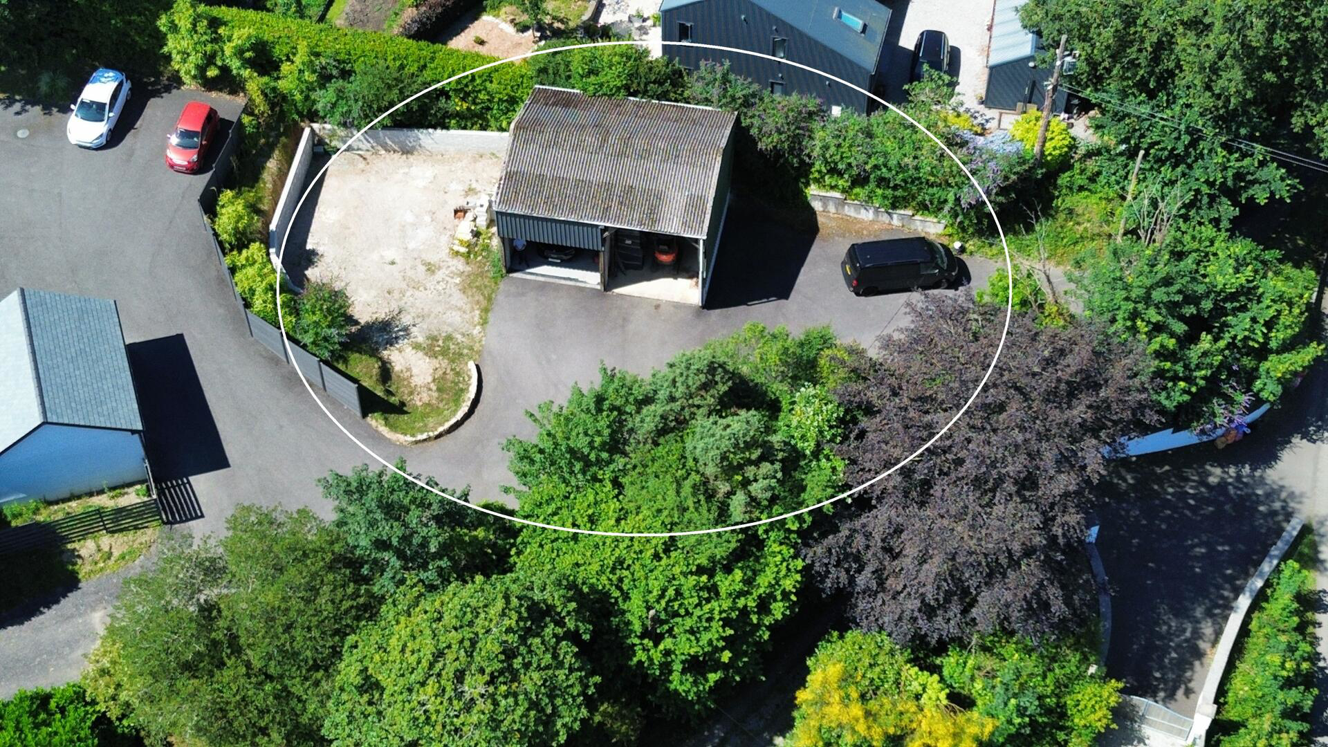
Conditional planning consent has been granted to convert this modern open fronted barn to a detached family home which the present owner has already completed much of the expensive preparation. A great opportunity to construct a new home in a lovely rural location and within a particular sought after village.
The home, in the agent’s words
Read the full agent description
Conditional planning consent has been granted to convert this modern open fronted barn to a detached family home which the present owner has already completed much of the expensive preparation. A great opportunity to construct a new home in a lovely rural location and within a particular sought after village. Planning details can be viewed via reference PA25/00164 Why You'll Like It - Conditional planning consent has been granted to convert and extend this modern open fronted barn to a detached family home which the present owner has already completed much of the expensive preparation. The land itself measures approximately 40 meters x 20 meters. A great opportunity to construct a new home in a lovely rural location and within a particular sought after village. Planning details can be viewed via reference PA25/00164 Where It Is - Perranwell Station is a thriving village where you'll find a community run village shop, pub, primary school and bus stops all also a pleasant stroll away. Located only approximately 6 miles or so from Truro and 5 miles from Falmouth, the village has a host of beautiful rural walks on the doorstep and the Bissoe Trail is just down the road where you can enjoy walking, running or cycling between the north and south coasts. The village has a thriving community hall, football club and cricket club and sailors will love nearby Mylor where there is a marina and access to the sailing waters of the River Fal. Residents of the village love the community, its gorgeous rural setting and the convenience of this location. Tenure And Services - The tenure is Freehold. Services are already within a few metres. CIL liability £7672.45 further details on the planning portal. Important Information - Clive Pearce Property, their clients and any joint agents give notice that: 1. They are not authorised to make or give any representations or warranties in relation to the property either here or elsewhere, either on their own behalf or on behalf of their client or otherwise. They assume no responsibility for any statement that may be made in these particulars. These particulars do not form part of any offer or contract and must not be relied upon as statements of fact. 2 It should not be assumed that the property has all necessary planning, building regulation or other consents and Clive Pearce Property have not tested any services, equipment or facilities. Purchasers must satisfy themselves by inspection or otherwise. 3. Photos and Videos: The photographs and/or videos show only certain parts of the property as they appeared at the time they were taken. Areas, measurements and distances given are approximate only. Any computer generated image gives only an indication as to how the property may look and this may change at any time. Any reference to alterations to, or use of, any part of the property does not mean that any necessary planning, building regulations or other consent has been obtained. A buyer must find out by inspection or in other ways that these matters have been properly dealt with and that all information is correct. Information on the website about a property is liable to be changed at any time.
A feel for the area
Connected for everyday life
13%of homes in the postcode can access 100+ Mbps broadband.
Available speed bands
- 30+ Mbps
- 100%
- 100+ Mbps
- 13%
- 300+ Mbps
- 13%
- 1,000+ Mbps
- 13%
Getting about
0.2 milesto Perranwell Rail Station
Approximate straight-line distance · DfT NaPTAN · 13 Sept 2026Background air quality
- Fine particles · PM₂.₅
- 5.1 µg/m³ · Above the WHO guideline · well within the UK legal limit
- Nitrogen dioxide · NO₂
- 3.2 µg/m³ · Meets the WHO guideline
Annual background levels. For scale: the WHO 2021 guideline is 5 µg/m³ for PM₂.₅ and 10 for NO₂; the UK legal limit is 20 and 40. Lower is better; this is a 1 km model, not a reading at the door.
Defra · 2024 annual model · 1 km areaLocal information is approximate. Distances are straight-line estimates from the available location. Broadband describes postcode coverage, not the speed or service available at this home; check the address with a provider. Air quality is a modelled annual background estimate.
Picture your everyday
Start with the agent's details and explore the area guide to get a feel for daily life here.
Other homes nearby
Homes in TR3 postcode area →About these property details
The information provided in this listing is for general information purposes only and does not constitute property particulars. We make no warranties or guarantees, express or implied, regarding the accuracy, completeness, or availability of the information.
Property details are provided by the listing agent, developer, or other third parties, and we have no control over the content provided. Prospective buyers or tenants should make their own enquiries and verify all information directly with the agent or relevant party.
Information relating to Energy Performance Certificates, Home Reports, or other statutory documents should be obtained directly from the selling agent or developer where applicable.