

Ashford, Surrey · TW15
Staines Road West, Ashford
Staines Road West, Ashford, Surrey, TW15
Asking price · Originally listed at £650,000
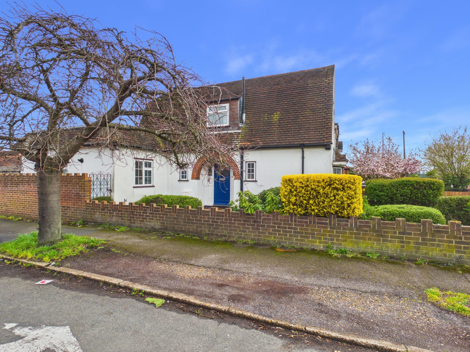
Situated on Staines Road West and nestled at the top of the sought after residential street of The Drive, this substantial four/five-bedroom detached family home offers exceptionally versatile living accommodation and sits on a generous corner plot.
The home, in the agent’s words
Read the full agent description
Situated on Staines Road West and nestled at the top of the sought after residential street of The Drive, this substantial four/five bedroom detached family home offers exceptionally versatile living accommodation and sits on a generous corner plot. Larger than average, the property provides flexible space that could easily accommodate up to five bedrooms, making it ideal for growing families or those seeking adaptable living arrangements. To the first floor, there are three well-proportioned bedrooms along with a family bathroom. The ground floor boasts a range of reception rooms, offering excellent flexibility for both everyday living and entertaining. Additional benefits include a utility room and a convenient ground floor toilet. Externally, the property enjoys a secluded setting with both front and rear gardens, providing a high degree of privacy. A gated driveway offers ample off-street parking and leads to a large double garage. This is a rare opportunity to acquire a spacious and highly adaptable home in a desirable location. EPC Rating D.
Spelthorne Borough Council, Council Tax Band E being £3,087.93 for 2026/27.
A feel for the area
Connected for everyday life
100%of homes in the postcode can access 100+ Mbps broadband.
Available speed bands
- 30+ Mbps
- 100%
- 100+ Mbps
- 100%
- 300+ Mbps
- 100%
- 1,000+ Mbps
- 100%
Getting about
0.7 milesto Upper Halliford Rail Station
Approximate straight-line distance · DfT NaPTAN · 13 Sept 2026Background air quality
- Fine particles · PM₂.₅
- 7.9 µg/m³ · Above the WHO guideline · well within the UK legal limit
- Nitrogen dioxide · NO₂
- 14.6 µg/m³ · Above the WHO guideline · well within the UK legal limit
Annual background levels. For scale: the WHO 2021 guideline is 5 µg/m³ for PM₂.₅ and 10 for NO₂; the UK legal limit is 20 and 40. Lower is better; this is a 1 km model, not a reading at the door.
Defra · 2024 annual model · 1 km areaLocal information is approximate. Distances are straight-line estimates from the available location. Broadband describes postcode coverage, not the speed or service available at this home; check the address with a provider. Air quality is a modelled annual background estimate.
Checking nearby places…
Picture your everyday
Start with the agent's details and explore the area guide to get a feel for daily life here.
Other homes nearby
Homes in TW15 postcode area →About these property details
The information provided in this listing is for general information purposes only and does not constitute property particulars. We make no warranties or guarantees, express or implied, regarding the accuracy, completeness, or availability of the information.
Property details are provided by the listing agent, developer, or other third parties, and we have no control over the content provided. Prospective buyers or tenants should make their own enquiries and verify all information directly with the agent or relevant party.
Information relating to Energy Performance Certificates, Home Reports, or other statutory documents should be obtained directly from the selling agent or developer where applicable.