

Holsworthy, Devon · EX22
Brandis Corner, Holsworthy
Brandis Corner, Holsworthy, Devon, EX22
Guide price
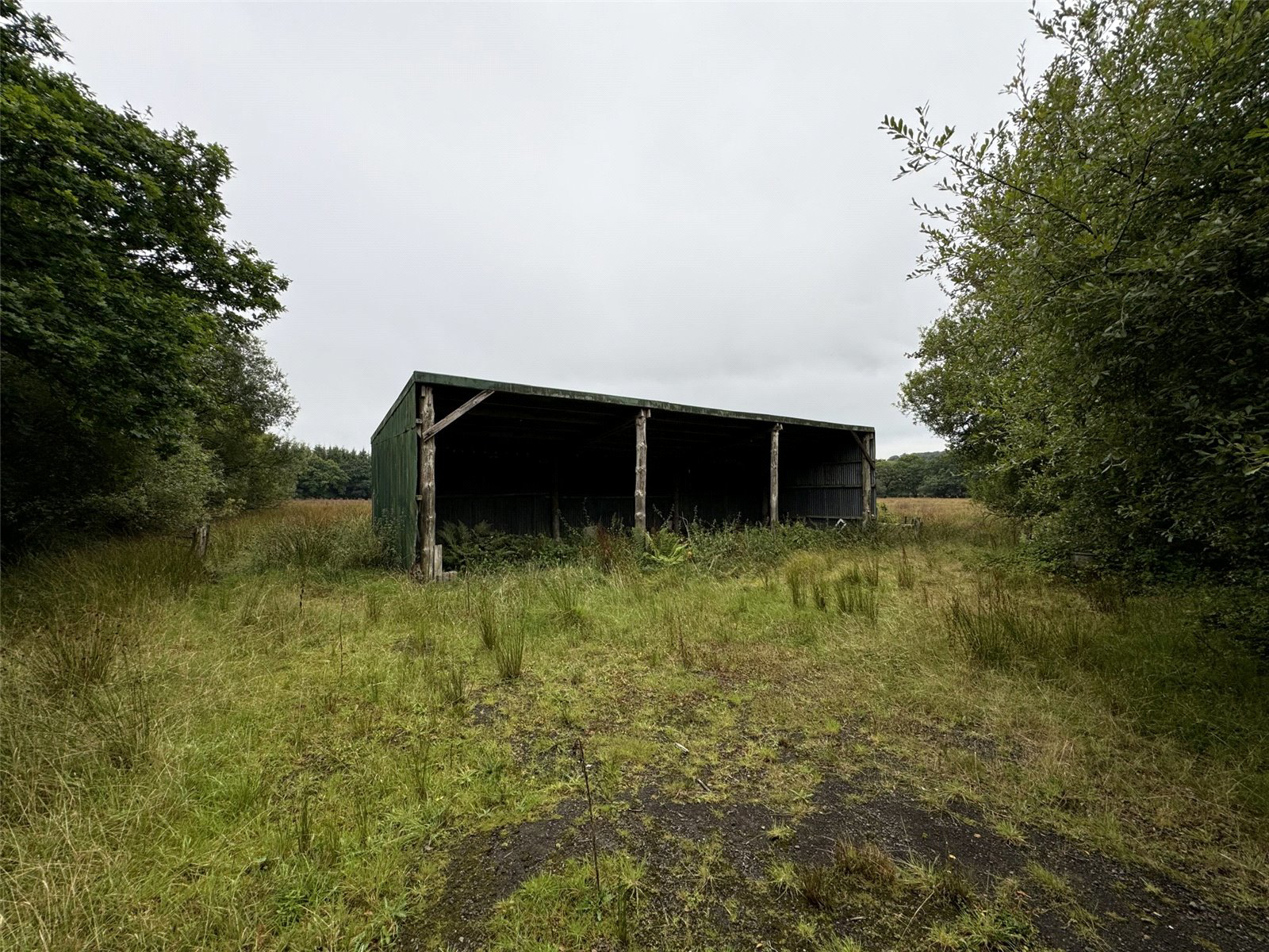
A rare and exciting opportunity to acquire approx. 40 acres of land situated a short distance from the Market Town of Holsworthy. The land is easily accessed via 2 entrances off the A3079 and is arranged over 3 paddocks. The land is predominately level pasture land with a small area of woodland and is bordered by natural Devon Hedgerow and mature native trees. The parcels of land would benefit from some general maintenance and management. Within the grounds there are a couple of useful agricultural pole barns, which may have development potential (subject to gaining the necessary consents). All viewings to be accompanied by a member of the Holsworthy Bond Oxborough Phillips team.
The home, in the agent’s words
- APPROXIMATELY 40 ACRES
- ARRANGED OVER 3 FIELDS
- RANGE OF OUTBUILDINGS
- DEVELOPMENT POTENTIAL SUBJECT TO GAINING NECESSARY CONSENTS
- DEVON HEDGEROW BOUNDARIES
- 2 GOOD POINTS OF ACCESS FROM THE A3079
- A SHORT DRIVE TO THE POPULAR MARKET TOWN OF HOLSWORTHY & OKEHAMPTON/A30
Read the full agent description
Located a short distance from the Market Town of Holsworthy with convieniant access off the A3079 via a 5 bar gate. An access lane leads to an open fronted three bay pole barn. The land totals approximately 40 acres arranged over three fields with natural Devon hedgerow boundaries. The land would benefit from some general maintenance and management and is predominantly level ground with some gently sloping, south facing areas.
A feel for the area
Connected for everyday life
100%of homes in the postcode can access 100+ Mbps broadband.
Available speed bands
- 30+ Mbps
- 100%
- 100+ Mbps
- 100%
- 300+ Mbps
- 100%
- 1,000+ Mbps
- 100%
Getting about
12.7 milesto Okehampton Rail Station
Approximate straight-line distance · DfT NaPTAN · 13 Sept 2026Background air quality
- Fine particles · PM₂.₅
- 4.7 µg/m³ · Meets the WHO guideline
- Nitrogen dioxide · NO₂
- 2.0 µg/m³ · Meets the WHO guideline
Annual background levels. For scale: the WHO 2021 guideline is 5 µg/m³ for PM₂.₅ and 10 for NO₂; the UK legal limit is 20 and 40. Lower is better; this is a 1 km model, not a reading at the door.
Defra · 2024 annual model · 1 km areaLocal information is approximate. Distances are straight-line estimates from the available location. Broadband describes postcode coverage, not the speed or service available at this home; check the address with a provider. Air quality is a modelled annual background estimate.
Picture your everyday
Start with the agent's details and explore the area guide to get a feel for daily life here.
Other homes nearby
Homes in EX22 postcode area →About these property details
The information provided in this listing is for general information purposes only and does not constitute property particulars. We make no warranties or guarantees, express or implied, regarding the accuracy, completeness, or availability of the information.
Property details are provided by the listing agent, developer, or other third parties, and we have no control over the content provided. Prospective buyers or tenants should make their own enquiries and verify all information directly with the agent or relevant party.
Information relating to Energy Performance Certificates, Home Reports, or other statutory documents should be obtained directly from the selling agent or developer where applicable.